Nub Tsho Na Pata trek, Haa. The Valley is a nestled paradise connecting the Paro, Chhukha, and Samtse districts of Bhutan. The Haa Valley is one of the best lesser-known valleys in Bhutan to visit, having only opened to tourism in 2002.
Part of the Jigme Khesar Strict Nature Reserve, the only strict nature reserve in the country. Home of the snow leopards. Abode of Ap Chundu. Tough, treacherous paths, climbs that literally take your breath away and knee-crunching descents on the last day. But totally worth every ounce of strength and determination. The highest point on the trek is around 4480 Mts above sea level.
Paro International Airport.
Starts in Haa and ends at Haa.
Moderate
3940 meters at Regotsho Pass.
70 km from the starting point to the end Point.
The Nub Tshonapata Trek takes you through the mountains of Haa in Western Bhutan. The trek is considered unique and unexplored as many do not trek this region because this trail was recently introduced in the trekking program.


Upon arrival at Paro airport, received by a representative from our company, transfer to the hotel. Nestled within the breathtaking landscapes of the Eastern Himalayas, Paro, Bhutan’s charming valley town, welcomes travellers with open arms, promising a journey into the heart of an ancient kingdom steeped in tradition and natural beauty.
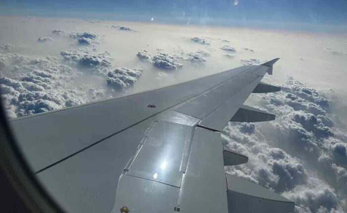
As your plane descends into Paro International Airport, the views are nothing short of spectacular. The lush green valleys, cascading waterfalls, and majestic peaks create a serene backdrop, setting the stage for an unforgettable adventure.
Stepping off the plane, you’re greeted by crisp mountain air and the warm smiles of locals, whose genuine hospitality is a hallmark of Bhutanese culture. The airport itself reflects the country’s commitment to preserving its rich heritage, with traditional architecture and meticulous attention to detail.
Leaving the airport behind, the journey into Paro town unveils a tapestry of sights and sounds that captivate the senses. Colourful prayer flags flutter in the breeze, while ornate temples and monasteries dot the landscape, offering glimpses into Bhutan’s spiritual heritage. Dinner and overnight at the hotel in Paro.
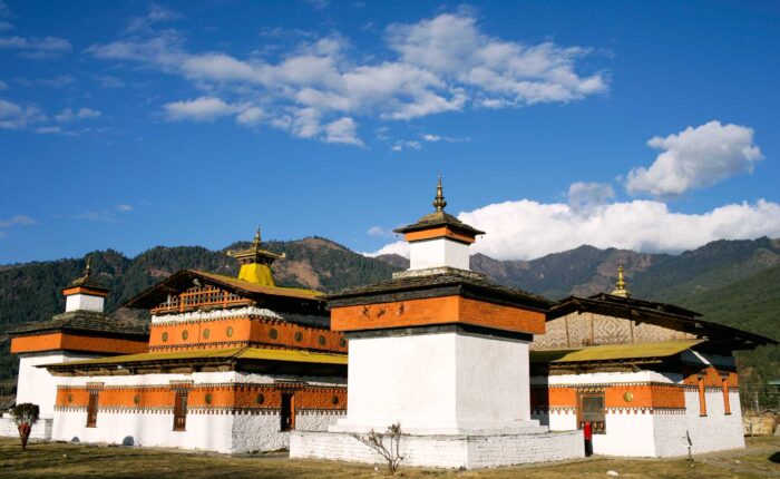
Haa is also known as “the hidden Land Rice valley” Haa major feature is its narrow north-south valley. Its new Dzong is built in 1915 near the older one which is destroyed by fire. Haa is the ancient route for trade with Bhutanese with Yatung and Chumbi valley in Tibet. Walk around the Haa valley and acclimatize before we begin the trek. Today we take rest and plan ourself mentally to begin the Trek next day.
Distance:22Km | Walking Time:7 Hours |Campsite altitude:2700m|Ascent:220m | Descent:55m
After early breakfast, the trek begins from Haa to Womji. Today your tour starts with a gentle climb up the Talela Pass at 3780m through a thick forest of rhododendron and conifer trees. You will continue gradually ascending to a yak herders’ camp at Tshojo. Climb up further to Gochula pass, which is at 4200m. After this pass, walk through the trail following a ridge and descend gradually to our camp at Womji.
Distance:22Km|Walking Time:8 Hours|Campsite Altitude:3700M|Ascent:650m
The trek begins from Womji to tshona. Today after breakfast, you will start climbing steeply through the juniper and rhododendron forest to the Gochhila pass at 4350m, providing spectacular views of the whole Tshejala range. You will pass through several yak herders’ camps, and the trail will be carpeted with wildflowers in spring. You will then walk towards Tshejala pass crossing the ancient trade route from Haa to Tibet.
Distance:8 Km|Walking Time:5 Hours|Campsite Altitude:3940M
Today we shall take the last walk. This morning you will retrace as far as Gochhila Pass before branching off on a different route over a ridge to Lake Tshojo at 3780m. You will have a picnic lunch on the lakeshore. After lunch, you will descend to the camp in a yak meadow at Tshojo.
Distance:18Km|Walking Time:6 Hours|Ascent:650m|Descent:650m
Your trail descends gradually through the juniper and rhododendron forest until you reach the Talila Pass, which you will Cross to re-enter the Haa Valley. Your trek ends here and your transport will be waiting to take you to Paro. Overnight hotel in Paro
Drive to Paro via Chelela Pass. Visit Farmhouse and enjoy the Hotstone bath at Paro. Paro is one of the most beautiful, well-preserved valleys and the country’s only international airport. Its beauty, plane valley, and iconic Tiger Nest temple make it one of the most iconic places to visit.
Facts about Paro: Tiger Nest Temple is located in Paro.
Drive to the Airport and See off. Your trek ends today. Hope you had a wonderful time in Bhutan exploring the remotest part of the Country.