Rodung La Trek is the new trek introduced recently in Bhutan. The trail used to be the old route for Bhutanese people during olden times to reach eastern Bhutan. The course does not have any high altitude but has steep climbs and starts from central Bhutan to far eastern unexplored routes.
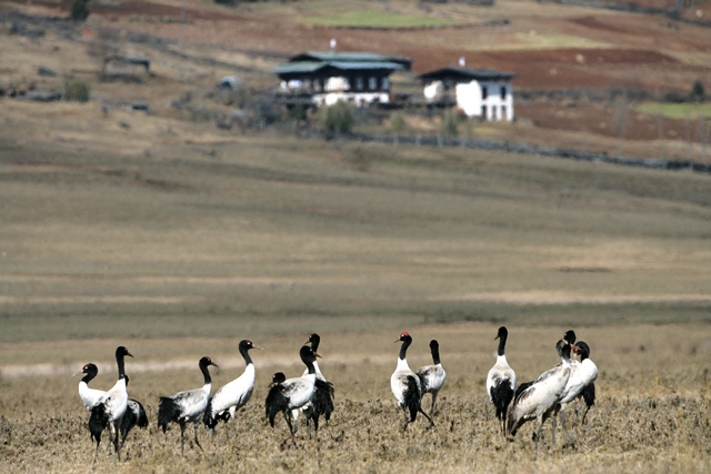
The trail passes through alpine and bamboo forests, meadows and mountain passes, villages and temples offering hikers an incredible array of biodiversity to appreciate. The trek can be covered in 10 days but we can shorten it as per the needs of the clients.
Paro International Airport.
Starts in Bumthang and ends at Trashi Yangtse.
Moderate
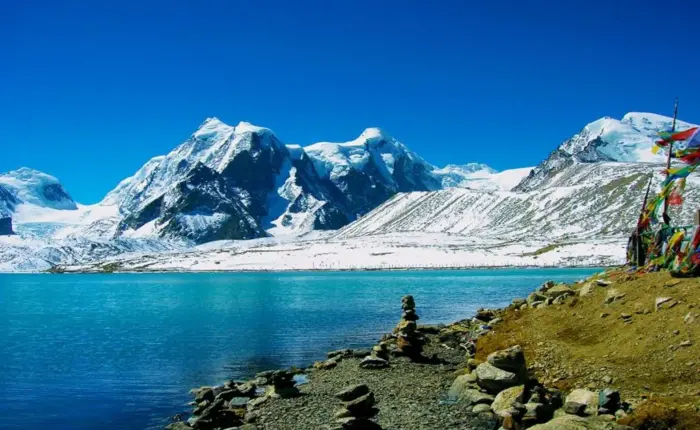
Phephe La pass (3,353m)
166 km from the starting point to the end Point.
The Rodungla Trek is a captivating trekking route in Bhutan, renowned for its moderate difficulty level and stunning landscapes. Trekkers traverse the Rodung La Pass, situated at an elevation of approximately 4,160 meters (13,648 feet), enjoying panoramic views of Bhutan’s picturesque valleys and mountain ranges. This trek offers a balanced adventure, making it accessible to trekkers with some experience, and provides an immersive experience into Bhutan’s natural beauty and local culture. The trek is often completed in about a week, making it an ideal choice for those seeking a shorter yet rewarding trekking experience in the Land of the Thunder Dragon.


Upon arrival at Paro airport, received by representative from our company, transfer to the hotel. Dinner and overnight at the hotel in Paro.
Fly to Bumthang via flight which takes 30 minutes and our guide will receive you at the airport and take you for cultural sightseeing. There is a popular festival in Bumthang where visitors can enjoy the unique festival of the east. Overnight at Hotel.
Distance:20Km|Walking Time:6/7 Hours|Campsite Altitude:2800M|Ascent:650m
The route takes you around Chamkhar Chhu, a river rich in trout. After passing Thangbi Lhakhang, a temple built by the first Karma Shamar in the 13th century you will enter Ngang Yul or ‘Swan Land” named for the swans that were once common in this part of the valley. Near the center of this area, you will find Ngang Lhakhang, the “Swan Temple”. The Ngang Lhakhang was erected by the Lama Namkha Samdrup in the spot where his arrow landed. The design of the Lhakhang was inspired by a vision he had.
Distance:15Km|Walking Time:6/7 Hours|Campsite Altitude:2800M|Ascent:
You begin with a gradual climb to Phephe La pass (3,353m). Follow the trail until the pass takes you through a picturesque forested region. It is recommended that you allow for stops along the way to enjoy the natural beauty of the surroundings. You will stop for the night at Ogyen Choling Manor. This manor houses one of the most interesting museums of Bhutan and visitors will gain a better understanding of the lives of the landed gentry in traditional Bhutanese society.
Distance:17 Km|Walking Time:5/6 Hours|Campsite Altitude:3680M|Ascent:920m
Today’s walk is through bamboo, hemlock, and finally up to an alpine forest. The camp is in a meadow at the head of the valley. (Distance is 17 km, Time 5 to 6 hours, Camp altitude is 3680m, Ascent is 920m)
Distance:20Km|Walking Time:6/7 Hours|Camping Altitude: 2950
Rodung La (4,160m) is about three hour climb from the camp. From the pass you then continue downhill through a gorge, overlooking scenic mountain valleys covered in lush pine forests. The region is rich in folklore concerning spirits and yetis. Near the camp, you can see a ruined stone building that once acted as a grain storehouse during the reigns of the first and second kings.
Distance is 18km, Time 6 to 7 hours, Camp altitude is 1720m)
From your camp, the trail goes down to a stream and back up to a basic health unit and a community school in Gorsam. Further on, you pass a Tibetan-style Umling Mani, built by a lama from Tibet, and a chorten on Zerim La (1,940m). Before reaching the next pass, Tage La (1,760m) you will see Menjabi, a beautiful Bhutanese village with large white houses. The campsite for the night is located South-east of Tage La near Tangmachu High School. Another possibility is to organize transport and drive to Lhuentse, the capital of Lhuentse district. Lhuntese Dzong is considered to be one of the most impressive dzongs in Bhutan.
Distance is 16km, Time 4 to 5 hours, Camp altitude is 1830m)
After arriving at Kuri Zampa the trek begins to gradually climb up through paddy fields and villages before bringing you to Chusa.
Distance is 20km, Time 5 to 6 hours, Camp altitude is 2450m)
Today’s trek has you continue uphill through thick forests overlooking spectacular mountains. The camp is located in a forested area at an altitude of 2,400m.
Distance is 24km, Time 8 to 9 hours
Today is the longest day of the trek. It is a gradual descent to Trashi Yangtse. As you descend oak trees slowly replace the chirping and hardwood forests. The final camp of the trek is located in a subtropical forested region.
Today our team will drop you to Guwahati from Bhutan.